Looking for design inspiration? Browse our curated collections!

Joined
2012
Followers
1,619
Visitors
9,983,245

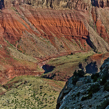
Yaki Point in the Grand Canyon National Park
The trailhead for the South Kaibab Trail is located off of the Yaki Point Road, which is closed to private vehicles. The free Grand Canyon National Park shuttle bus is the only way to access the trailhead. The trailhead also marks the eastern terminus of the Rim Trail. From the trailhead, the trail heads north. Hikers begin with a steep descent through the Grand Canyon's upper rock layers: the Kaibab Limestone and Toroweap Formation. At about 1/2 mile one can observe an excellent example of a pustule dome. Here a small deposit of less dense more buoyant evaporite has punctured through a layer of harder limestone above. Through the first ¾ mile, the trail cuts through the eastern side of Pipe Creek Canyon until Ooh-ahh Point, where the canyon walls turn around Yaki Point and the view of the eastern canyon opens up. The point is named after a common reaction to the view. From Ooh-ahh Point the trail turns around a few switchbacks in a natural break in the Coconino Sandstone until Cedar Ridge, where the trail begins to level off slightly. Cedar Ridge has toilet facilities and offers a place for hikers and mule trains to rest. Below here, the trail continues north around the east site of O'Neill Butte, descending gradually through the Hermit Shale and Supai Group to Skeleton Point, three miles (5 km) from the trailhead. After Skeleton Point, the trail begins a sharp descent through a natural break in the Redwall Limestone. Despite the name, the natural color of the rock is light beige or gray. The trail cuts to the west of the point where hikers can get a view of Phantom Ranch, then quickly back to the east side of the point. There are numerous switchbacks to descend the 1,200 feet (370 m) through the Redwall Limestone, Muav Limestone, and Bright Angel Shale to the junction with the Tonto Trail, 4½ miles from the trailhead.